2008
NX4283 : Gully on the Rig of Loch Enoch
taken 16 years ago, near to Gloon Burn [water Feature], Dumfries And Galloway, Great Britain
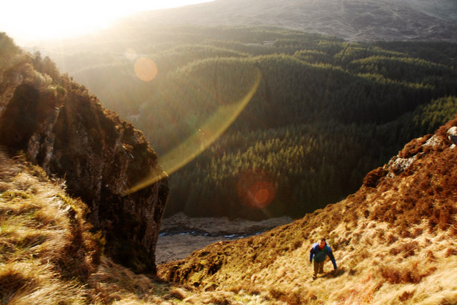
Gully on the Rig of Loch Enoch
Walking up a steep gully on the west side of the Rig of Loch Enoch. Buchan Burn is visible in the valley below, with the flank of Benyellary beyond.
 Map © Crown Copyright")
TIP: Click the map for more Large scale mapping
- Grid Square
- NX4283, 2 images (more nearby 🔍)
- Photographer
- Steve B (more nearby)
- Date Taken
- Friday, 21 March, 2008 (more nearby)
- Submitted
- Friday, 26 December, 2008
- Subject Location
-
OSGB36:
 NX 425 831 [100m precision]
WGS84: 55:7.0429N 4:28.2279W - Camera Location
-
OSGB36: NX 428 830
- View Direction
- West-northwest (about 292 degrees)