2006
SN3125 : West side of the Dewi Fawr valley
taken 18 years ago, near to Pen-y-Bont, Carmarthenshire/Sir Gaerfyrddin, Wales
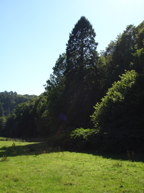
West side of the Dewi Fawr valley
The large fir tree marks the position of Ddolwen, a now ruined cottage last inhabited in the 19th Century.
 Map © Crown Copyright")
TIP: Click the map for more Large scale mapping
- Grid Square
- SN3125, 8 images (more nearby 🔍)
- Photographer
- Emrys Harries (more nearby)
- Date Taken
- Thursday, 3 August, 2006 (more nearby)
- Submitted
- Monday, 5 January, 2009
- Subject Location
-
OSGB36:
 SN 310 250 [100m precision]
WGS84: 51:53.8819N 4:27.4521W - Camera Location
-
OSGB36: SN 310 250
- View Direction
- Southwest (about 225 degrees)