2009
TF4044 : Butterwick old Roman sea bank
taken 15 years ago, near to Benington, Lincolnshire, England
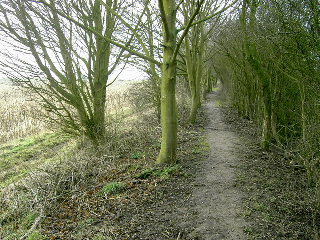
Butterwick old Roman sea bank
This old Roman seabank runs 300 metres Parallel to the sea defences built around the end of the 1800s and 1000 metres behind the reclaimed land of the 1960`s. It can be followed in many places from Skegness to Fosdyke and beyond.
Many parts are now tree lined, and give good cover for breeding game such as pheasants, where local farms hold regular shoots during the winter months on the reclaimed land to the east.
Many parts are now tree lined, and give good cover for breeding game such as pheasants, where local farms hold regular shoots during the winter months on the reclaimed land to the east.
 Map © Crown Copyright")
TIP: Click the map for more Large scale mapping
- Grid Square
- TF4044, 31 images (more nearby 🔍)
- Photographer
- Paul Hudson (more nearby)
- Date Taken
- Sunday, 25 January, 2009 (more nearby)
- Submitted
- Sunday, 25 January, 2009
- Subject Location
-
OSGB36:
 TF 408 446 [100m precision]
WGS84: 52:58.8248N 0:5.8138E - Camera Location
-
OSGB36: TF 409 446
- View Direction
- Southwest (about 225 degrees)