2006
NZ2187 : Electricity substation
taken 18 years ago, near to Pegswood, Northumberland, England
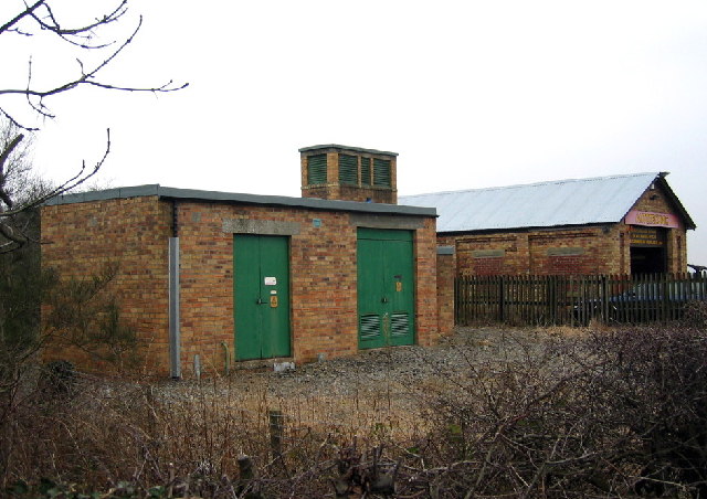
Electricity substation
These two buildings in the middle of nowhere appear on the 1940's OS map. The one in the background is now used for commercial vehicle repairs... but what was its original use?
On the 1919-1926 map old mine workings are indicated, ie shafts. On the 1894-1899 maps, nothing is there. It would appear that the building must have had some association with mine working. For a bit more information see the link Link and scroll down to 21st entry, (Shafts).
On the 1919-1926 map old mine workings are indicated, ie shafts. On the 1894-1899 maps, nothing is there. It would appear that the building must have had some association with mine working. For a bit more information see the link Link
 Map © Crown Copyright")
TIP: Click the map for more Large scale mapping
- Grid Square
- NZ2187, 19 images (more nearby 🔍)
- Photographer
- Alan Fearon (more nearby)
- Date Taken
- Thursday, 2 February, 2006 (more nearby)
- Submitted
- Friday, 3 February, 2006
- Subject Location
-
OSGB36:
 NZ 212 870 [100m precision]
WGS84: 55:10.6109N 1:40.1203W