2007
TG2508 : Thorpe St Andrew and Whitlingham Lake from Pinebanks Tower
taken 17 years ago, near to Thorpe st Andrew, Norfolk, England
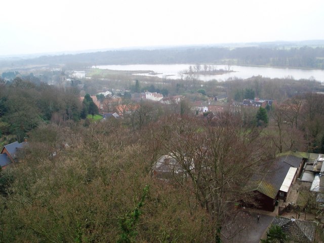
Thorpe St Andrew and Whitlingham Lake from Pinebanks Tower
The Village of Thorpe St Andrew, with the church to the left, and the River Yare just beyond. Further off is the large expanse of Whitlingham Lake, recently formed as a country park from a former gravel pit.
The view was taken on a miserable day from the top of the folly at Pinebanks - on a clear day, the sea is said to be visible from here.
The view was taken on a miserable day from the top of the folly at Pinebanks - on a clear day, the sea is said to be visible from here.
 Map © Crown Copyright")
TIP: Click the map for more Large scale mapping
- Grid Square
- TG2508, 195 images (more nearby 🔍)
- Photographer
- Gareth Hughes (more nearby)
- Date Taken
- Tuesday, 30 January, 2007 (more nearby)
- Submitted
- Monday, 16 February, 2009
- Subject Location
-
OSGB36:
 TG 258 081 [100m precision]
WGS84: 52:37.4515N 1:20.1249E - Camera Location
-
OSGB36: TG 254 086
- View Direction
- Southeast (about 135 degrees)