J3268 : The Minnowburn Bridge near Belfast (11)
taken 15 years ago, 3 km from Drumbeg, Co Down, Northern Ireland
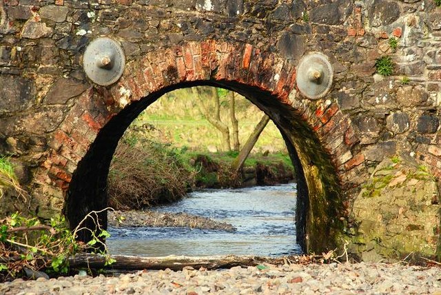
The Minnowburn Bridge near Belfast (11)
See J3268 : The Minnowburn Bridge near Belfast (10). With the snow melted and no rain of any consequence over the last few days, the Minnowburn was low. This is the middle arch. J3268 : The Minnowburn Bridge near Belfast (8) shows the river at a higher level.
![Creative Commons Licence [Some Rights Reserved]](https://s1.geograph.org.uk/img/somerights20.gif)
|
· Find out How to reuse this image ·
Share:
|
|||||
| Start a discussion on J3268 | Suggest an update to this image | Contact the contributor | |||
Loading map... (JavaScript required)
- Grid Square
- J3268, 816 images (more nearby
 )
)
- Photographer
- Albert Bridge (find more nearby)
- Date Taken
- Tuesday, 17 February, 2009 (more nearby)
- Submitted
- Tuesday, 17 February, 2009
- Category
- Bridge (more nearby)
- Subject Location
-
Irish:
 J 325 686 [100m precision]
WGS84: 54:32.9019N 5:57.1124W - Camera Location
-
Irish: J 326 686
- View Direction
- WEST (about 270 degrees)
Image classification(about):
Geograph
This page has been viewed about 80 times.
View this location:
KML (Google Earth) ·
Google Maps ·
Bing Maps ·
Geograph Coverage Map ·
More Links for this image
·
Bing Maps ·
Geograph Coverage Map ·
More Links for this image