2009
NS3678 : Ladder-like pattern of ditches, Carman Muir
taken 15 years ago, near to Renton, West Dunbartonshire, Scotland
Ladder-like pattern of ditches, Carman Muir
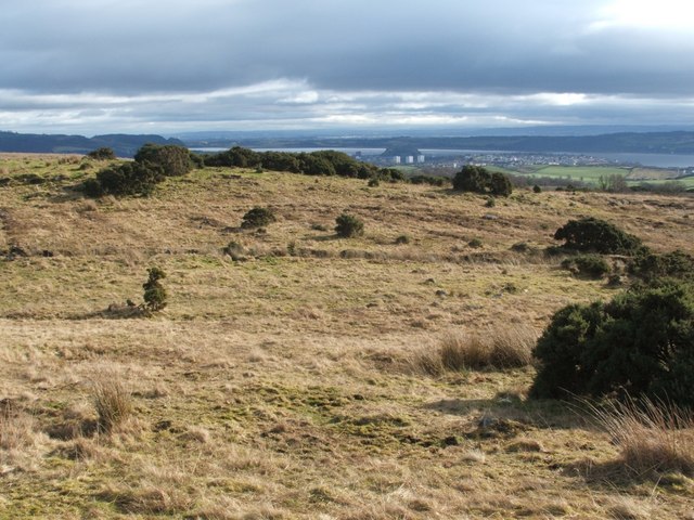
A prominent ladder-like pattern of ditches runs for a considerable distance across this part of Carman Muir, providing drainage for forestry planting which never happened; see NS3678 : Area of Carman Muir scored with ditches (as noted there, the area had also been covered with trees at an earlier period).
In the area shown here, the nearer of the two long channels running from left to right was the deeper, and, when this picture was taken, contained water. The ditches forming the "rungs" of the pattern are rather less deep, and make an angle of about 60° with the two main ditches.
In the background, just right of centre, the volcanic plug of Dumbarton Rock Link is visible on the nearer shore of the River Clyde, with the three high flats of West Bridgend in front of it (NS3975 : The high flats at West Bridgend). Also located on this side of the river, and visible in the left-hand side of the image, is the plateau of the Kilpatrick Hills, with NS4274 : Dumbuck Quarry at its right-most tip.
 Map © Crown Copyright")
TIP: Click the map for more Large scale mapping
- Grid Square
- NS3678, 137 images (more nearby 🔍)
- Photographer
- Lairich Rig (more nearby)
- Date Taken
- Monday, 23 February, 2009 (more nearby)
- Submitted
- Wednesday, 25 February, 2009
- Subject Location
-
OSGB36:
 NS 3699 7825 [10m precision]
WGS84: 55:58.1696N 4:36.8082W - Camera Location
-
OSGB36: NS 3695 7831
- View Direction
- South-southeast (about 157 degrees)