1978
NS6167 : Remploy Factory Springburn
taken 46 years ago, near to Springburn, Glasgow, Scotland
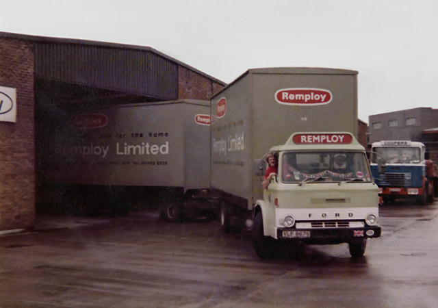
Remploy Factory Springburn
This picture was taken in 1978 at the Remploy factory in Springburn when in those days all the manufactured products were transported
to the distribution warehouse in Oldham Lancashire by vehicles like these.
In 1978 this factory used to make chairs for offices and schools.
Remploy was set up under the 1944 Disabled Persons Employment Act by Ernest Bevin, who was then minister of labour.
The firm was formally founded in April 1945 and its first factory opened in Bridgend, South Wales, in 1946 where it made violins and furniture and many of the workers were disabled miners.
Derived from 're-employ', the name was adopted by Remploy in 1946; before then it was called the Disabled Persons Employment Corporation.
From its beginnings more than 60 years ago, the company developed a factory network throughout the UK which operated in a diverse variety of businesses.
Remploy's work has included the manufacture of motor components, school furniture and making chemical, biological and nuclear protection suits for police and military in the UK and overseas.
In 2007 Remploy was in the news after an announcement was made of plans to close 43 factories around the UK.Link
two of which can be seen below
TQ2081 : Remploy factory, North Acton
SO2105 : Medallion House, Cwmtillery Estate
 Map © Crown Copyright")
TIP: Click the map for more Large scale mapping
- Grid Square
- NS6167, 31 images (more nearby 🔍)
- Photographer
- Paul Anderson (more nearby)
- Date Taken
- March 1978 (more nearby)
- Submitted
- Thursday, 5 March, 2009
- Subject Location
-
OSGB36:
 NS 610 674 [100m precision]
WGS84: 55:52.8000N 4:13.3937W - Camera Location
-
OSGB36: NS 610 674
- View Direction
- West-northwest (about 292 degrees)