2002
SD8322 : Newchurch Unitarian Chapel
taken 22 years ago, near to Waterfoot, Lancashire, England
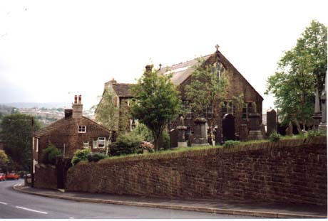
Newchurch Unitarian Chapel
Called the Bethlehem Chapel, it is located on a road called Turnpike leading up the hill from Waterfoot into Newchurch.
 Map © Crown Copyright")
TIP: Click the map for more Large scale mapping
- Grid Square
- SD8322, 110 images (more nearby 🔍)
- Photographer
- John Bayes (more nearby)
- Date Taken
- February 2002 (more nearby)
- Submitted
- Sunday, 22 March, 2009
- Subject Location
-
OSGB36:
 SD 835 223 [100m precision]
WGS84: 53:41.8125N 2:15.0826W - Camera Location
-
OSGB36: SD 833 224
- View Direction
- East-southeast (about 112 degrees)