J3472 : The Ormeau Bridge, Belfast
taken 15 years ago, near to Belfast, Co Antrim, Northern Ireland
This is 1 of 3 images, with title The Ormeau Bridge, Belfast in this square
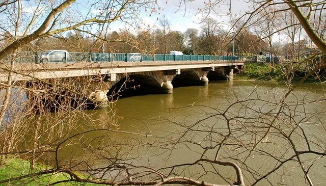
The Ormeau Bridge, Belfast
The view is downstream from the Stranmillis Embankment J3371 : The Stranmillis Embankment, Belfast.
The Ormeau Bridge, Belfast
Lanyons Queens Bridge J3474 : The Queen's Bridge, Belfast (2) opened in 1843. There is more than a hint of déjà vu in his design for the Ormeau Bridge which opened 20 years later. It suffered a similar fate in widening with his symmetric arches now partly hidden by the later decking. Work on the bridges predecessor is said to have started in 1815 with completion in 1818 or 1822 (depending on source). It seems, however, that it was unstable and was later demolished to be replaced by the present structure. It carries the main road to Downpatrick and Newcastle/Kilkeel.
![Creative Commons Licence [Some Rights Reserved]](https://s1.geograph.org.uk/img/somerights20.gif)
|
· Find out How to reuse this image ·
Share:
|
|||||
| Start a discussion on J3472 | Suggest an update to this image | Contact the contributor | |||
Loading map... (JavaScript required)
- Grid Square
- J3472, 419 images (more nearby
 )
)
- Photographer
- Albert Bridge (find more nearby)
- Date Taken
- Monday, 23 March, 2009 (more nearby)
- Submitted
- Tuesday, 24 March, 2009
- Geographical Context
- Place (from Tags)
- Category
- Bridge (more nearby)
- Subject Location
-
Irish:
 J 344 725 [100m precision]
WGS84: 54:34.9789N 5:55.3004W - Camera Location
-
Irish: J 343 725
- View Direction
- East-southeast (about 112 degrees)
Other Tags
Image classification(about):
Geograph
This page has been viewed about 255 times.
View this location:
KML (Google Earth) ·
Google Maps ·
Bing Maps ·
Geograph Coverage Map ·
More Links for this image
·
Bing Maps ·
Geograph Coverage Map ·
More Links for this image