2007
SP8246 : Tathall End during flash flood, Summer 2007
taken 17 years ago, near to Hanslope, Milton Keynes, England
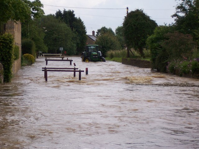
Tathall End during flash flood, Summer 2007
The tractor gives an indication of water depth on the road. Local residents described this as the highest water level reached in over 30 years, and followed just two 10 minute thunderstorms.
 Map © Crown Copyright")
TIP: Click the map for more Large scale mapping
- Grid Square
- SP8246, 13 images (more nearby 🔍)
- Photographer
- Gary Metherell (more nearby)
- Date Taken
- Monday, 2 July, 2007 (more nearby)
- Submitted
- Tuesday, 24 March, 2009
- Subject Location
-
OSGB36:
 SP 820 469 [100m precision]
WGS84: 52:6.8876N 0:48.1819W - Camera Location
-
OSGB36: SP 820 469
- View Direction
- South-southwest (about 202 degrees)