2009
NZ0742 : Saltersgate Lane, history uncertain
taken 15 years ago, 4 km WSW of Satley, County Durham, England
This is 1 of 3 images, with title starting with Saltersgate in this square
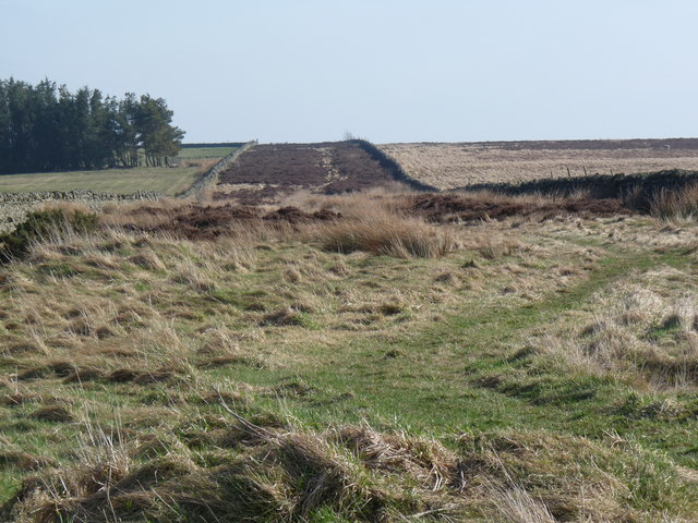
Saltersgate Lane, history uncertain
A near identical picture to that taken by Oliver Dixon NZ0742 : Parallel walls, Saltersgate Lane
It seems possible that this was formerly a track or tramway built for transporting minerals from the many quarries nearby. At the north westerly end of the track (180 degrees from this view) there is a building which could have been a planned railway station that never opened (Saltersgate Cottage)
For more detailed info see Link
The lane appears on circa 1856-1865 maps available via Link
 Map © Crown Copyright")
TIP: Click the map for more Large scale mapping
- Grid Square
- NZ0742, 32 images (more nearby 🔍)
- Photographer
- Ian Porter (more nearby)
- Date Taken
- Thursday, 19 March, 2009 (more nearby)
- Submitted
- Saturday, 4 April, 2009
- Subject Location
-
OSGB36:
 NZ 078 424 [100m precision]
WGS84: 54:46.6196N 1:52.7318W - Camera Location
-
OSGB36: NZ 077 426
- View Direction
- Southeast (about 135 degrees)