2009
NZ1139 : The Old Vicarage, Tow Law
taken 15 years ago, near to Tow Law, County Durham, England
This is 1 of 2 images, with title The Old Vicarage, Tow Law in this square
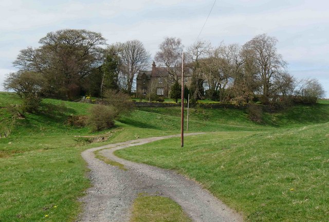
The Old Vicarage, Tow Law
This house is shown as "The Parsonage" on old OS maps. Assuming it is associated with the church of St. Philip & St. James, it will probably be circa 1869 when the church was consecrated by Bishop Charles Baring. The Bishop was related to the Baring family associated with the now demised Barings Bank.
The church project itself struggled financially at the time so it seems unlikely that a substantial Parsonage would have been built simultaneously.
If you know more of the history I would love to hear from you.
For more information see the Tow Law Deerness and District History Society website.
Link (Archive Link )
The church project itself struggled financially at the time so it seems unlikely that a substantial Parsonage would have been built simultaneously.
If you know more of the history I would love to hear from you.
For more information see the Tow Law Deerness and District History Society website.
Link
 Map © Crown Copyright")
TIP: Click the map for more Large scale mapping
- Grid Square
- NZ1139, 80 images (more nearby 🔍)
- Photographer
- Ian Porter (more nearby)
- Date Taken
- Monday, 13 April, 2009 (more nearby)
- Submitted
- Monday, 13 April, 2009
- Subject Location
-
OSGB36:
 NZ 1130 3912 [10m precision]
WGS84: 54:44.8148N 1:49.5588W - Camera Location
-
OSGB36: NZ 1138 3904
- View Direction
- Northwest (about 315 degrees)