2008
SP6921 : River Ray, Grendon Wood
taken 16 years ago, near to Grendon Underwood, Buckinghamshire, England
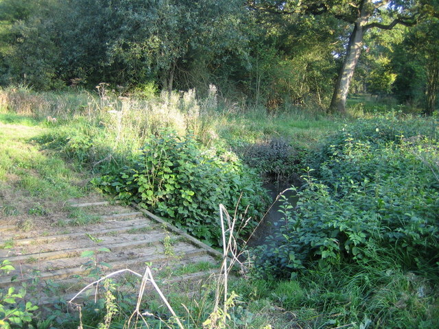
River Ray, Grendon Wood
Looking east, this stream, which flows east to west through Grendon Wood, is the River Ray. The source of the river is a spring on the northern slope of Grange Hill near Shipton Lee, SP73982127 4km to the east. From Grendon Wood, the river flows south-west through farmland and joins the River Cherwell at Islip Weir about 22km away, which itself joins the River Thames (or Isis) in Oxford.
Here is the river further west near the village of Blackthorn on the Buckinghamshire-Oxfordshire border, SP6320 : Flooded River Ray. The upper River Ray area is one of the last strongholds for threatened wading birds and traditional floodplain meadows in England, Link .
.
There is another River Ray west of Swindon that flows into the Thames east of Cricklade SU122939.
Here is the river further west near the village of Blackthorn on the Buckinghamshire-Oxfordshire border, SP6320 : Flooded River Ray. The upper River Ray area is one of the last strongholds for threatened wading birds and traditional floodplain meadows in England, Link
There is another River Ray west of Swindon that flows into the Thames east of Cricklade SU122939.
 Map © Crown Copyright")
TIP: Click the map for more Large scale mapping
- Grid Square
- SP6921, 27 images (more nearby 🔍)
- Photographer
- Andy Gryce (more nearby)
- Date Taken
- Saturday, 27 September, 2008 (more nearby)
- Submitted
- Monday, 20 April, 2009
- Subject Location
-
OSGB36:
 SP 699 213 [100m precision]
WGS84: 51:53.1906N 0:59.1125W - Camera Location
-
OSGB36: SP 699 213
- View Direction
- EAST (about 90 degrees)