N8377 : St. Colmcille's Church, Fletcherstown, Co. Meath
taken 15 years ago, near to Wilkinstown, Co Meath, Ireland
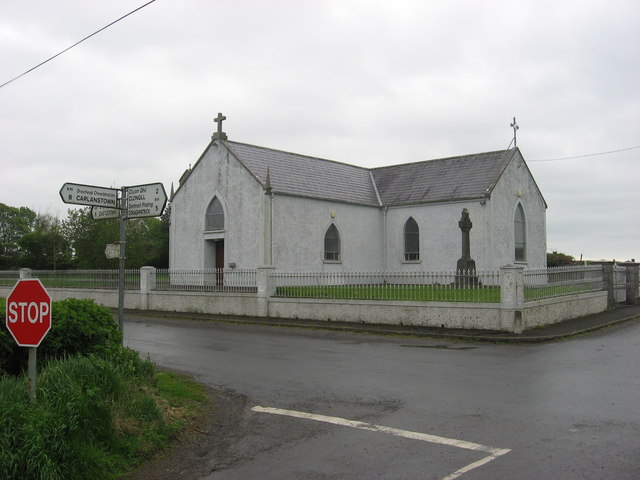
St. Colmcille's Church, Fletcherstown, Co. Meath
Early 19th-century T-Plan church. Named St. Mary's on the O.S. six-inch map.
![Creative Commons Licence [Some Rights Reserved]](https://s1.geograph.org.uk/img/somerights20.gif)
|
· Find out How to reuse this image ·
Share:
|
|||||
| Start a discussion on N8377 | Suggest an update to this image | Contact the contributor | |||
Loading map... (JavaScript required)
- Grid Square
- N8377, 2 images (more nearby
 )
)
- Photographer
- Kieran Campbell (find more nearby)
- Date Taken
- Wednesday, 29 April, 2009 (more nearby)
- Submitted
- Saturday, 2 May, 2009
- Category
- Religious buildings > Church (Roman Catholic) (more nearby)
- Subject Location
-
Irish:
 N 8315 7779 [10m precision]
WGS84: 53:44.5962N 6:44.4298W - Camera Location
-
Irish: N 8310 7777
- View Direction
- East-northeast (about 67 degrees)
This page has been viewed about 1787 times.
View this location:
KML (Google Earth) ·
Google Maps ·
Bing Maps ·
Geograph Coverage Map ·
More Links for this image
·
Bing Maps ·
Geograph Coverage Map ·
More Links for this image