J3273 : Roden Street, Belfast
taken 15 years ago, near to Belfast, Co Antrim, Northern Ireland
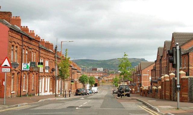
Roden Street, Belfast
Built around the mid-19th century as a short street off the Grosvenor Road, Roden Street eventually became a long street running through to the Donegall Road. Bisected by the building of the Westlink it was finally cut in two in 2008 when the rebuilding of the Westlink J3373 : The Westlink, Belfast (1) was completed. There is now no through road for motor vehicles. Pedestrians can still cross by a footbridge J3273 : Footbridge, Westlink, Belfast (1). This end (at the Donegall Road) has been redeveloped but still includes a few traditional terrace houses (left).
![Creative Commons Licence [Some Rights Reserved]](https://s1.geograph.org.uk/img/somerights20.gif)
|
· Find out How to reuse this image ·
Share:
|
|||||
| Start a discussion on J3273 | Suggest an update to this image | Contact the contributor | |||
Loading map... (JavaScript required)
- Grid Square
- J3273, 167 images (more nearby
 )
)
- Photographer
- Albert Bridge (find more nearby)
- Date Taken
- Sunday, 3 May, 2009 (more nearby)
- Submitted
- Sunday, 3 May, 2009
- Category
- Street (more nearby)
- Subject Location
-
Irish:
 J 326 733 [100m precision]
WGS84: 54:35.4326N 5:56.9297W - Camera Location
-
Irish: J 326 731
- View Direction
- NORTH (about 0 degrees)
Image classification(about):
Geograph
This page has been viewed about 790 times.
View this location:
KML (Google Earth) ·
Google Maps ·
Bing Maps ·
Geograph Coverage Map ·
More Links for this image
·
Bing Maps ·
Geograph Coverage Map ·
More Links for this image