2006
SD2174 : Level Crossing at Thwaite Flat
taken 18 years ago, near to Dalton-in-Furness, Cumbria, England
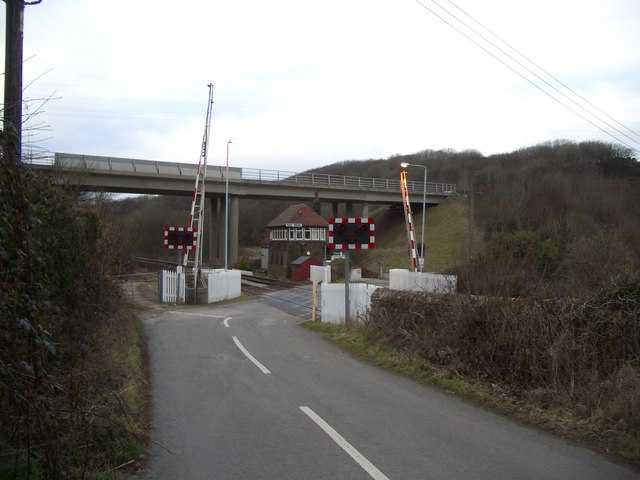
Level Crossing at Thwaite Flat
The roadbridge over the railway line is the A590 Dalton-in-Furness bypass which opened in about 1993
 Map © Crown Copyright")
TIP: Click the map for more Large scale mapping
- Grid Square
- SD2174, 7 images (more nearby 🔍)
- Photographer
- Lee Coward (more nearby)
- Date Taken
- Sunday, 26 February, 2006 (more nearby)
- Submitted
- Sunday, 26 February, 2006
- Subject Location
-
OSGB36:
 SD 215 742 [100m precision]
WGS84: 54:9.4552N 3:12.2160W