J5950 : Portaferry fire station
taken 15 years ago, near to Portaferry, Co Down, Northern Ireland
This is 1 of 2 images, with title Portaferry fire station in this square
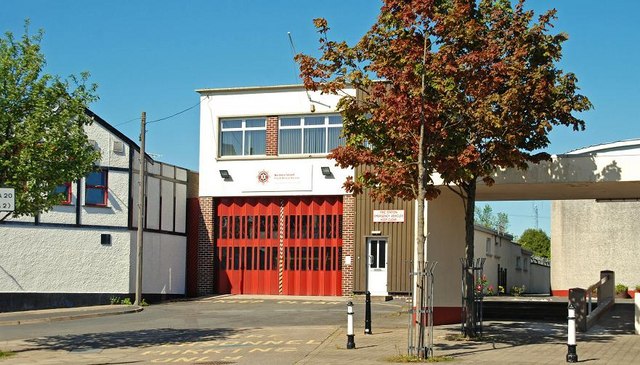
Portaferry fire station
Sitting between a church (right) and bar it makes an interesting comparison with D2818 : Gospel Hall and Fire Station, Carnlough.
Northern Ireland Fire and Rescue Service
A series of photographs showing appliances and fire stations etc of the Northern Ireland Fire and Rescue Service. It has no connection with the NIFRS.
![Creative Commons Licence [Some Rights Reserved]](https://s1.geograph.org.uk/img/somerights20.gif)
|
· Find out How to reuse this image ·
Share:
|
|||||
| Start a discussion on J5950 | Suggest an update to this image | Contact the contributor | |||
Loading map... (JavaScript required)
- Grid Square
- J5950, 351 images (more nearby
 )
)
- Photographer
- Albert Bridge (find more nearby)
- Date Taken
- Monday, 11 May, 2009 (more nearby)
- Submitted
- Tuesday, 12 May, 2009
- Category
- Fire station (more nearby)
- Subject Location
-
Irish:
 J 594 509 [100m precision]
WGS84: 54:22.9331N 5:32.8003W - Camera Location
-
Irish: J 594 509
- View Direction
- NORTH (about 0 degrees)
Image classification(about):
Geograph
This page has been viewed about 171 times.
View this location:
KML (Google Earth) ·
Google Maps ·
Bing Maps ·
Geograph Coverage Map ·
More Links for this image
·
Bing Maps ·
Geograph Coverage Map ·
More Links for this image