H0811 : North shore of St John's Lough
taken 15 years ago, 4 km NW of Fenagh, Co Leitrim, Ireland
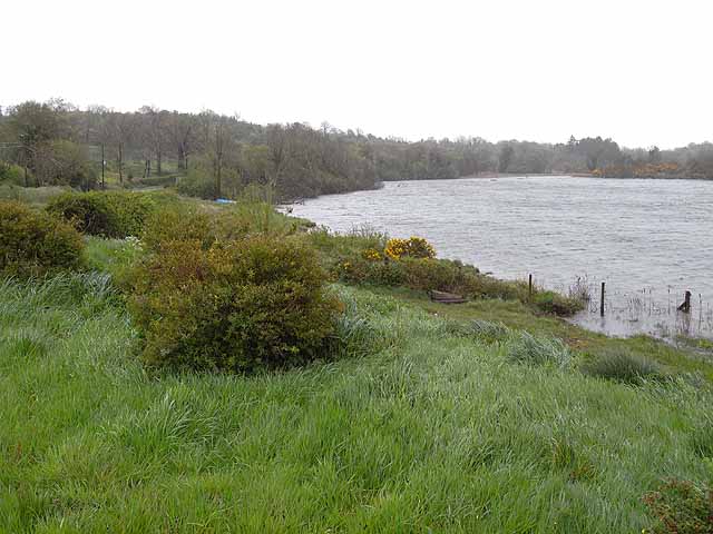
North shore of St John's Lough
The Irish lakeland of County Cavan and adjoining areas is dotted with innumerable small loughs nestling between the drumlins. St John's Lough lies within the south-eastern corner of County Leitrim and forms part of the Shannon-Erne Waterway.
The R208 Carrick-on-Shannon to Ballinamore main road runs along the north shore of the lough, making it much more accessible than most of the loughs in the region.
The R208 Carrick-on-Shannon to Ballinamore main road runs along the north shore of the lough, making it much more accessible than most of the loughs in the region.
![Creative Commons Licence [Some Rights Reserved]](https://s1.geograph.org.uk/img/somerights20.gif)
|
· Find out How to reuse this image ·
Share:
|
|||||
| Start a discussion on H0811 | Suggest an update to this image | Contact the contributor | |||
Loading map... (JavaScript required)
- Grid Square
- H0811, 2 images (more nearby
 )
)
- Photographer
- Oliver Dixon (find more nearby)
- Date Taken
- Thursday, 7 May, 2009 (more nearby)
- Submitted
- Sunday, 17 May, 2009
- Category
- Lobster and crab pots (more nearby)
- Subject Location
-
Irish:
 H 084 114 [100m precision]
WGS84: 54:3.1446N 7:52.3494W - Camera Location
-
Irish: H 082 115
- View Direction
- EAST (about 90 degrees)
This page has been viewed about 72 times.
View this location:
KML (Google Earth) ·
Google Maps ·
Bing Maps ·
Geograph Coverage Map ·
More Links for this image
·
Bing Maps ·
Geograph Coverage Map ·
More Links for this image