2009
NC9009 : Looking down to Badenahauglish and the Kintradwell Burn
taken 15 years ago, 3 km from Achrimsdale, Highland, Scotland
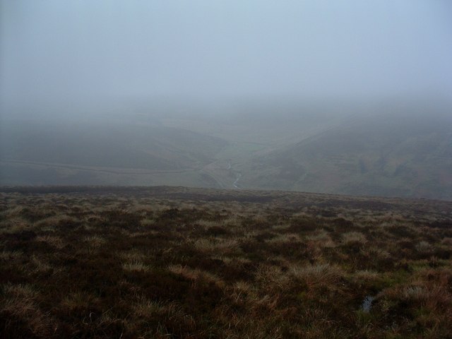
Looking down to Badenahauglish and the Kintradwell Burn
It has just been raining a bit, now the mist is rolling in, I think today's "stroll" may finish earlier than planned.
 Map © Crown Copyright")
TIP: Click the map for more Large scale mapping
- Grid Square
- NC9009, 6 images (more nearby 🔍)
- Photographer
- Alan Stewart (more nearby)
- Date Taken
- Monday, 25 May, 2009 (more nearby)
- Submitted
- Wednesday, 3 June, 2009
- Subject Location
-
OSGB36:
 NC 908 094 [100m precision]
WGS84: 58:3.6555N 3:51.0897W - Camera Location
-
OSGB36: NC 905 092
- View Direction
- East-northeast (about 67 degrees)