J3370 : The Lagan Meadows walk, Belfast (5)
taken 15 years ago, 3 km from Belfast, Co Antrim, Northern Ireland
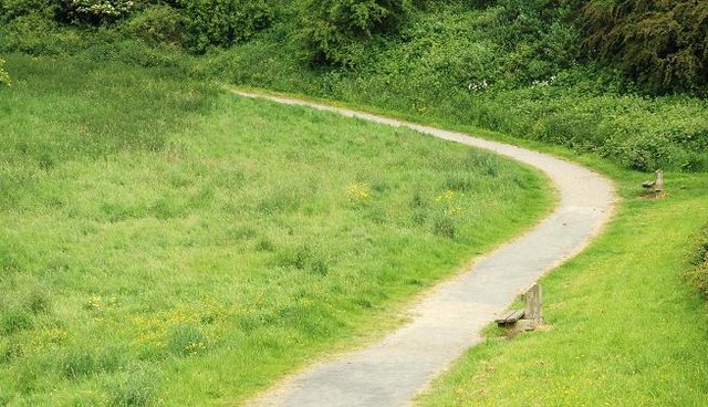
The Lagan Meadows walk, Belfast (5)
See J3370 : The Lagan Meadows walk, Belfast (4). Another steep part of the path (to the west of the previous photo). This is very close to suburbia but retains its rural feeling. Continue to J3370 : The Lagan Meadows walk, Belfast (6).
The Lagan Meadows, Belfast :: J3470
The Lagan Meadows is a public park of 120 acres administered by Belfast City Council. Its more than that however. In practice its a piece of completely rural countryside preserved in the middle of the Stranmillis and Malone areas of suburban south Belfast not far from the Lagan towpath. Although undulating most of it is fairly easy going but unassisted wheelchair users might have difficulty in some places.
![Creative Commons Licence [Some Rights Reserved]](https://s1.geograph.org.uk/img/somerights20.gif)
|
· Find out How to reuse this image ·
Share:
|
|||||
| Start a discussion on J3370 | Suggest an update to this image | Contact the contributor | |||
Loading map... (JavaScript required)
- Grid Square
- J3370, 158 images (more nearby
 )
)
- Photographer
- Albert Bridge (find more nearby)
- Date Taken
- Thursday, 4 June, 2009 (more nearby)
- Submitted
- Friday, 5 June, 2009
- Category
- Path > Path (more nearby)
- Subject Location
-
Irish:
 J 334 705 [100m precision]
WGS84: 54:33.9501N 5:56.2991W - Camera Location
-
Irish: J 334 705
- View Direction
- North-northwest (about 337 degrees)
Image classification(about):
Geograph
This page has been viewed about 55 times.
View this location:
KML (Google Earth) ·
Google Maps ·
Bing Maps ·
Geograph Coverage Map ·
More Links for this image
·
Bing Maps ·
Geograph Coverage Map ·
More Links for this image