2009
NM8944 : Clach Tholl
taken 15 years ago, near to Port Appin, Argyll And Bute, Scotland
This is 1 of 7 images, with title Clach Tholl in this square
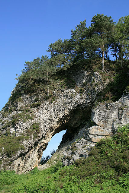
Clach Tholl
This rock arch (Holed Rock) is set in spectacular cliffs at the headland to the southwest of Port Appin.
 Map © Crown Copyright")
TIP: Click the map for more Large scale mapping
- Grid Square
- NM8944, 44 images (more nearby 🔍)
- Photographer
- Walter Baxter (more nearby)
- Date Taken
- Monday, 1 June, 2009 (more nearby)
- Submitted
- Saturday, 6 June, 2009
- Subject Location
-
OSGB36:
 NM 8996 4479 [10m precision]
WGS84: 56:32.8798N 5:25.1136W - Camera Location
-
OSGB36: NM 8996 4477
- View Direction
- NORTH (about 0 degrees)