2006
NG4474 : Road to Balmacquien
taken 18 years ago, near to Balmaqueen, Isle of Skye, Scotland
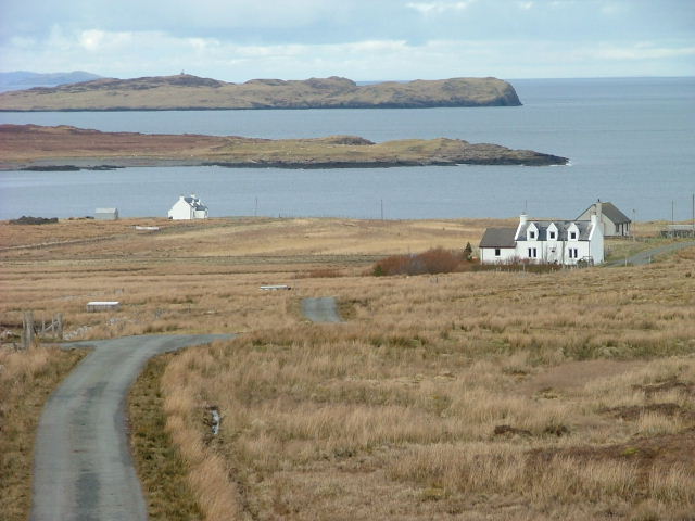
Road to Balmacquien
Gaelic spelling "Baile Mhic Chuithein" A crofting township on the Trotternish Peninsula.Interestingly, the signpost to the township is spelled "Balmaquien", whilst the OS 1:50,000 map has it as "Balmaqueen".
 Map © Crown Copyright")
TIP: Click the map for more Large scale mapping
- Grid Square
- NG4474, 22 images (more nearby 🔍)
- Photographer
- Dave Fergusson (more nearby)
- Date Taken
- Wednesday, 8 March, 2006 (more nearby)
- Submitted
- Wednesday, 8 March, 2006
- Subject Location
-
OSGB36:
 NG 443 743 [100m precision]
WGS84: 57:41.1749N 6:17.4921W - Camera Location
-
OSGB36: NG 442 740
- View Direction
- North-northeast (about 22 degrees)