2009
SZ0382 : Studland: postbox № BH19 79, Ferry Road
taken 15 years ago, near to Studland, Dorset, England
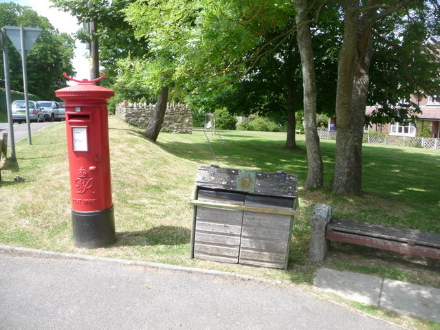
Studland: postbox № BH19 79, Ferry Road
This George VI-reign postbox stands opposite the SZ0382 : Studland: the post office and stores and is emptied finally at 4:30pm on weekdays and at 10:30am on Saturdays unsurprisingly, the latest times of the four boxes in the village.
 Map © Crown Copyright")
TIP: Click the map for more Large scale mapping
- Grid Square
- SZ0382, 389 images (more nearby 🔍)
- Photographer
- Chris Downer (more nearby)
- Date Taken
- Sunday, 21 June, 2009 (more nearby)
- Submitted
- Monday, 22 June, 2009
- Subject Location
-
OSGB36:
 SZ 034 824 [100m precision]
WGS84: 50:38.5146N 1:57.1797W - Camera Location
-
OSGB36: SZ 034 824
- View Direction
- WEST (about 270 degrees)