2009
SU0300 : Colehill: postbox № BH21 214, Canford View Drive
taken 15 years ago, near to Colehill, Dorset, England
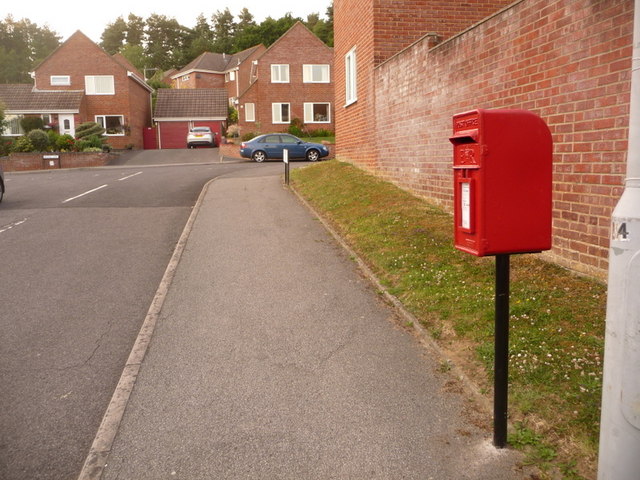
Colehill: postbox № BH21 214, Canford View Drive
This small postbox serves an estate whose roads are named after equestrian terms, with a couple of exceptions: Bridle Way is at the top of the hill, and it has turnings such as Farriers, Horseshoe, Stirrup and Harness Close. The box is emptied finally at 5:15pm on weekdays and at noon on Saturdays.
 Map © Crown Copyright")
TIP: Click the map for more Large scale mapping
- Grid Square
- SU0300, 27 images (more nearby 🔍)
- Photographer
- Chris Downer (more nearby)
- Date Taken
- Wednesday, 24 June, 2009 (more nearby)
- Submitted
- Wednesday, 24 June, 2009
- Subject Location
-
OSGB36:
 SU 039 008 [100m precision]
WGS84: 50:48.4531N 1:56.7355W - Camera Location
-
OSGB36: SU 039 008
- View Direction
- NORTH (about 0 degrees)