2005
NR6879 : The end of Rubha na Cille
taken 19 years ago, near to Keillmore, Argyll And Bute, Scotland
This is 1 of 2 images, with title The end of Rubha na Cille in this square
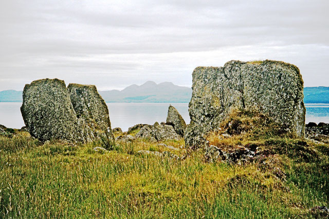
The end of Rubha na Cille
This is looking south west across to the Paps of Jura.
 Map © Crown Copyright")
TIP: Click the map for more Large scale mapping
- Grid Square
- NR6879, 18 images (more nearby 🔍)
- Photographer
- Dutyhog (more nearby)
- Date Taken
- Tuesday, 20 September, 2005 (more nearby)
- Submitted
- Thursday, 25 June, 2009
- Subject Location
-
OSGB36:
 NR 6820 7910 [10m precision]
WGS84: 55:56.9309N 5:42.8518W - Camera Location
-
OSGB36: NR 6822 7912
- View Direction
- Southwest (about 225 degrees)