H1308 : Aghoo Lock
taken 15 years ago, 3 km from Ballinamore, Co Leitrim, Ireland
This is 1 of 3 images, with title Aghoo Lock in this square
Aghoo Lock
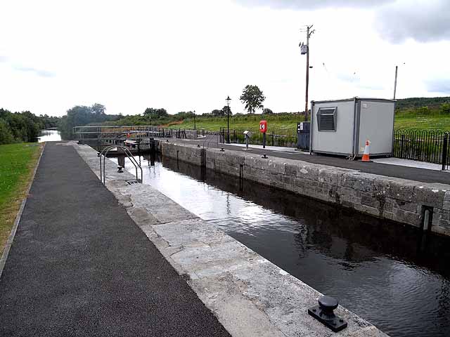
The first attempts to construct a canal linking the Shannon and Erne dated back to 1780, but it was not until 1847 that construction of what was then known as the Ballinamore and Ballyconnell Canal started in earnest. By the time of completion in 1858, money had run out, competition from the railways severely impacted on the canal's commercial viability, and the requirements of drainage over-rode the requirements of navigation. Over the course of nine years, only eight boats were recorded as using the canal (although others probably did so without paying their dues). The canal was thereupon abandoned for navigation and the construction of railway bridges with low headroom over the canal put the final nails in the coffin of a project which had never been properly completed in the first place.
The idea of connecting the two main river systems of Ireland was revived in 1988 as a flagship project of cooperation between the Irish Republic and Northern Ireland. Work started in 1990 with completion in 1994. Essentially a new construction along the line of the old canal, the waterway links a number of loughs along the way. The canal is 61 km long and links the Shannon at Leitrim village with the Erne downstream from Belturbet. There are 16 locks on the canal; the Aghoo Lock is the fifth on the eastern section on the descent from the summit level of Lough Scur, bringing the waterway down to the level of Garadice Lough.
The Waterway is a major tourist attraction - not only being used by boats, but also followed by a waymarked footpath and scenic drive. The Kingfisher Trail, the first signed cycle route to be established in Ireland, follows parts of the Waterway.
![Creative Commons Licence [Some Rights Reserved]](https://s1.geograph.org.uk/img/somerights20.gif)
|
· Find out How to reuse this image ·
Share:
|
|||||
| Start a discussion on H1308 | Suggest an update to this image | Contact the contributor | |||
Loading map... (JavaScript required)
- Grid Square
- H1308, 3 images (more nearby
 )
)
- Photographer
- Oliver Dixon (find more nearby)
- Date Taken
- Sunday, 5 July, 2009 (more nearby)
- Submitted
- Sunday, 19 July, 2009
- Category
- Lock (more nearby)
- Subject Location
-
Irish:
 H 138 089 [100m precision]
WGS84: 54:1.7847N 7:47.3819W - Camera Location
-
Irish: H 137 089
- View Direction
- EAST (about 90 degrees)
This page has been viewed about 4950 times.
View this location:
KML (Google Earth) ·
Google Maps ·
Bing Maps ·
Geograph Coverage Map ·
More Links for this image
·
Bing Maps ·
Geograph Coverage Map ·
More Links for this image