J3375 : The Westlink, York Street, Belfast
taken 15 years ago, near to Belfast, Co Antrim, Northern Ireland
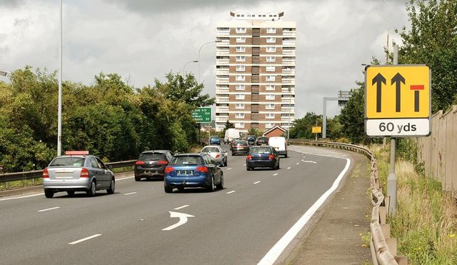
The Westlink (opened in two stages in 1981 and 1983 and upgraded in 2008) was meant to connect the M1 and M2 motorways bypassing the centre of Belfast. Despite various proposals over the years the road and the M2 remain unconnected. Access to the latter is by means of an at grade crossing, controlled by traffic lights, at York Street. The M3, between the Sydenham bypass and the M2 (completed in 1998) although close to the Westlink at Nelson Street remains unconnected.
There are plans (unlikely to be completed in my lifetime) to build grade-separated connecting roads (using underpasses rather than elevated roads as envisaged when the Westlink opened). If the scheme proceeds (remembering that NI road schemes are rarely completed as planned) it will probably be the most expensive undertaken here.
The photographs submitted by me appear as a matter of geographical and historical record only. I have no connection with the Roads Service or any campaign for or against the proposed scheme.
This is a useful unofficial link Link.
![Creative Commons Licence [Some Rights Reserved]](https://s1.geograph.org.uk/img/somerights20.gif)
|
· Find out How to reuse this image ·
Share:
|
|||||
| Start a discussion on J3375 | Suggest an update to this image | Contact the contributor | |||
- Grid Square
- J3375, 279 images (more nearby
 )
)
- Photographer
- Albert Bridge (find more nearby)
- Date Taken
- Sunday, 26 July, 2009 (more nearby)
- Submitted
- Sunday, 26 July, 2009
- Category
- Road > Road (more nearby)
- Subject Location
-
Irish:
 J 339 751 [100m precision]
WGS84: 54:36.4247N 5:55.6725W - Camera Location
-
Irish: J 340 751
- View Direction
- West-northwest (about 292 degrees)