J3472 : Penrose Street, Belfast
taken 15 years ago, near to Belfast, Co Antrim, Northern Ireland
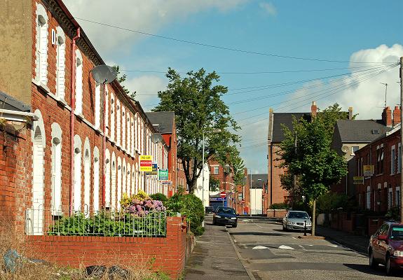
Penrose Street, Belfast
A late 19th century street running from Agincourt Avenue to Rugby Avenue (background).
![Creative Commons Licence [Some Rights Reserved]](https://s1.geograph.org.uk/img/somerights20.gif)
|
· Find out How to reuse this image ·
Share:
|
|||||
| Start a discussion on J3472 | Suggest an update to this image | Contact the contributor | |||
Loading map... (JavaScript required)
- Grid Square
- J3472, 419 images (more nearby
 )
)
- Photographer
- Albert Bridge (find more nearby)
- Date Taken
- Saturday, 22 August, 2009 (more nearby)
- Submitted
- Saturday, 22 August, 2009
- Category
- Street (more nearby)
- Subject Location
-
Irish:
 J 342 726 [100m precision]
WGS84: 54:35.0573N 5:55.4728W - Camera Location
-
Irish: J 342 726
- View Direction
- North-northwest (about 337 degrees)
Image classification(about):
Geograph
This page has been viewed about 75 times.
View this location:
KML (Google Earth) ·
Google Maps ·
Bing Maps ·
Geograph Coverage Map ·
More Links for this image
·
Bing Maps ·
Geograph Coverage Map ·
More Links for this image