2005
SO1864 : Cross Dyke
taken 19 years ago, 4 km SSW of Bleddfa, Powys, Wales
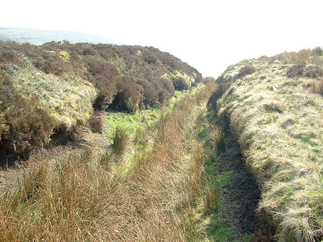
Cross Dyke
Marked on the 1:25,000 scale maps (but not the 1:50,000) the Cross Dyke is an earthwork across the narrow col between the Great Rhos hill and the Black Mixen hill.
 Map © Crown Copyright")
TIP: Click the map for more Large scale mapping
- Grid Square
- SO1864, 21 images (more nearby 🔍)
- Photographer
- Bill Rowley (more nearby)
- Date Taken
- Saturday, 2 April, 2005 (more nearby)
- Submitted
- Friday, 28 August, 2009
- Subject Location
-
OSGB36:
 SO 188 649 [100m precision]
WGS84: 52:16.6224N 3:11.4766W - Camera Location
-
OSGB36: SO 188 650
- View Direction
- South-southeast (about 157 degrees)