2009
NH4968 : Eastwards from Meall nan Tunn
taken 15 years ago, near to Meall Nan Tunn [hill or Mountain], Highland, Great Britain
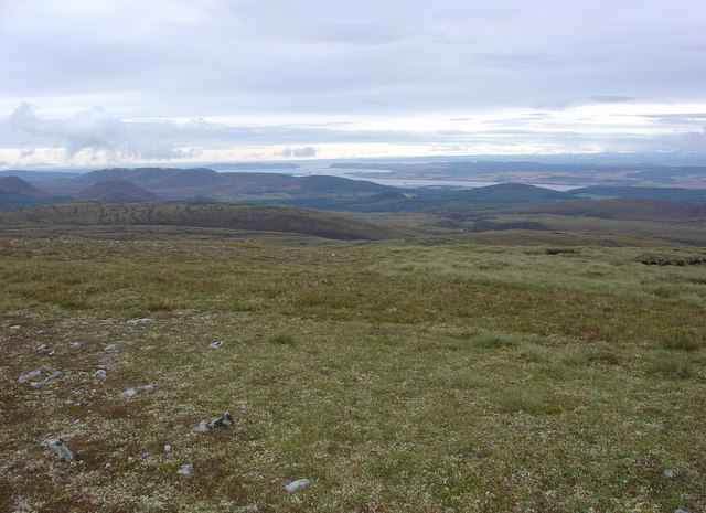
Eastwards from Meall nan Tunn
Looking eastwards from the relatively flat top of Meall nan Tunn. The Nigg and Cromarty Sutors, at the entrance to the Cromarty Firth, are clearly visible in the far distance.
 Map © Crown Copyright")
TIP: Click the map for more Large scale mapping
- Grid Square
- NH4968, 2 images (more nearby 🔍)
- Photographer
- Alasdair MacDonald (more nearby)
- Date Taken
- Thursday, 27 August, 2009 (more nearby)
- Submitted
- Sunday, 30 August, 2009
- Subject Location
-
OSGB36:
 NH 498 680 [100m precision]
WGS84: 57:40.6134N 4:31.2210W - Camera Location
-
OSGB36: NH 495 680
- View Direction
- EAST (about 90 degrees)