2009
NT3975 : View through the rain over East Lothian
taken 15 years ago, near to Cockenzie and Port Seton, East Lothian, Scotland
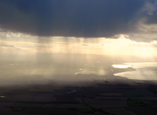
View through the rain over East Lothian
Taken from a microlight flight. We flew from East Fortune towards Aberlady and ahead could see a small area of rain although it was fine where we were. The power station at Cockenzie is clearly visible on the coast.
 Map © Crown Copyright")
TIP: Click the map for more Large scale mapping
- Grid Square
- NT3975, 962 images (more nearby 🔍)
- Photographer
- Lisa Jarvis (more nearby)
- Date Taken
- Sunday, 4 October, 2009 (more nearby)
- Submitted
- Tuesday, 6 October, 2009
- Subject Location
-
OSGB36:
 NT 395 755 [100m precision]
WGS84: 55:58.1419N 2:58.2506W - View Direction
- WEST (about 270 degrees)