2009
NS3679 : Start of track to Asker Farm
taken 15 years ago, near to Alexandria, West Dunbartonshire, Scotland
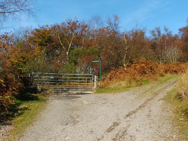
Start of track to Asker Farm
The gate is located partway up the track that is shown here: NS3679 : Access to Asker Farm and covered reservoir. The track on the other side of the gate leads towards and beyond Asker Farm, while the main uphill route leads to the waterworks.
The signpost gives (or rather gave see below) a distance of 4 km to Cardross, and 3 km to Renton.
By 2022, the part of the sign pointing to the left (4km to Cardross) had gone, leaving no indication that the corresponding route, which leads past Asker Farm, is in fact a core path; the part pointing downhill (3km to Renton) was still present. In addition, some hand-written signs (large ones, later replaced by smaller ones) with red text had appeared on and near the gate: "Danger: Shooting", "Keep Gate Closed", and "Dogs on Lead: Livestock".
Needless to say, it is still a core path.
 Map © Crown Copyright")
TIP: Click the map for more Large scale mapping
- Grid Square
- NS3679, 44 images (more nearby 🔍)
- Photographer
- Lairich Rig (more nearby)
- Date Taken
- Friday, 16 October, 2009 (more nearby)
- Submitted
- Saturday, 24 October, 2009
- Subject Location
-
OSGB36:
 NS 3682 7927 [10m precision]
WGS84: 55:58.7154N 4:37.0085W - Camera Location
-
OSGB36: NS 3683 7926
- View Direction
- North-northwest (about 337 degrees)