2009
SZ0378 : Graffiti at the bottom of the Zigzag Path
taken 14 years ago, near to Swanage, Dorset, England
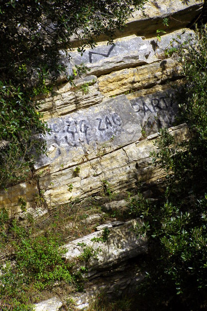
Graffiti at the bottom of the Zigzag Path
The so-called Zigzag Path is a zig-zag path that leads down from Belle Vue Road to the shore in the middle of Durlston Bay. At the bottom of the path is a little grassy terrace with a final drop of about two metres onto the rocky beach. Immediately to the north is this small promontory of cracked Middle Purbeck strata, on which someone has written graffiti.
 Map © Crown Copyright")
TIP: Click the map for more Large scale mapping
- Grid Square
- SZ0378, 836 images (more nearby 🔍)
- Photographer
- Jim Champion (more nearby)
- Date Taken
- Sunday, 25 October, 2009 (more nearby)
- Submitted
- Tuesday, 27 October, 2009
- Subject Location
-
OSGB36:
 SZ 0348 7804 [10m precision]
WGS84: 50:36.1243N 1:57.1312W - Camera Location
-
OSGB36: SZ 0347 7802
- View Direction
- North-northeast (about 22 degrees)