2005
TF1808 : Deeping Lakes Nature Reserve
taken 19 years ago, near to Peakirk, Peterborough, England
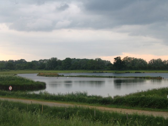
Deeping Lakes Nature Reserve
Flooded gravel pits near Deeping St. James which are now owned by the Lincolnshire Wildlife Trust and are run as a Nature Reserve open to the public (hence the 15mph sign!)
 Map © Crown Copyright")
TIP: Click the map for more Large scale mapping
- Grid Square
- TF1808, 57 images (more nearby 🔍)
- Photographer
- James (more nearby)
- Date Taken
- Sunday, 5 June, 2005 (more nearby)
- Submitted
- Sunday, 5 June, 2005
- Subject Location
-
OSGB36:
 TF 1857 0820 [10m precision]
WGS84: 52:39.5141N 0:14.9053W - Camera Location
-
OSGB36: TF 1875 0813
- View Direction
- West-northwest (about 292 degrees)