2009
NM8502 : Hill fort on Creag a'Chapuill
taken 14 years ago, near to Creaganterve Mhòr, Argyll And Bute, Scotland
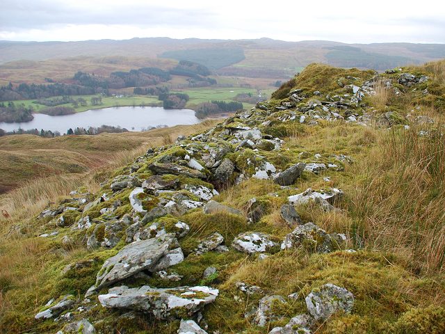
Hill fort on Creag a'Chapuill
Remains of what was once a massive wall on Creag a'Chapuill. Considered to be one of the largest defensive structures in Argyll, the stones have long been robbed for a modern field boundary wall.
 Map © Crown Copyright")
TIP: Click the map for more Large scale mapping
- Grid Square
- NM8502, 13 images (more nearby 🔍)
- Photographer
- Patrick Mackie (more nearby)
- Date Taken
- Sunday, 22 November, 2009 (more nearby)
- Submitted
- Sunday, 22 November, 2009
- Subject Location
-
OSGB36:
 NM 856 024 [100m precision]
WGS84: 56:9.9534N 5:27.2852W - View Direction
- East-southeast (about 112 degrees)