H8276 : Tullyhogue Fort
taken 15 years ago, near to Cookstown, Co Tyrone, Northern Ireland
Tullyhogue Fort
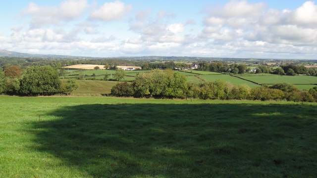
View from the fort, north towards Cookstown. The O'Neills knew a good view when they saw one.
![Creative Commons Licence [Some Rights Reserved]](https://s1.geograph.org.uk/img/somerights20.gif)
|
· Find out How to reuse this image ·
Share:
|
|||||
| Start a discussion on H8276 | Suggest an update to this image | Contact the contributor | |||
Loading map... (JavaScript required)
- Grid Square
- H8276, 2 images (more nearby
 )
)
- Photographer
- Iain Crump (find more nearby)
- Date Taken
- Sunday, 4 October, 2009 (more nearby)
- Submitted
- Saturday, 28 November, 2009
- Category
- Ancient site > Ancient site (more nearby)
- Subject Location
-
Irish:
 H 825 765 [100m precision]
WGS84: 54:37.8122N 6:43.3516W - Camera Location
-
Irish: H 825 743
- View Direction
- NORTH (about 0 degrees)
Image Type (about):
cross grid
This page has been viewed about 222 times.
View this location:
KML (Google Earth) ·
Google Maps ·
Bing Maps ·
Geograph Coverage Map ·
More Links for this image
·
Bing Maps ·
Geograph Coverage Map ·
More Links for this image