2009
TQ3579 : Blue Bell pub (site of) 12, St Marychurch Street, Rotherhithe, London, SE16
taken 14 years ago, near to Stepney, Tower Hamlets, England
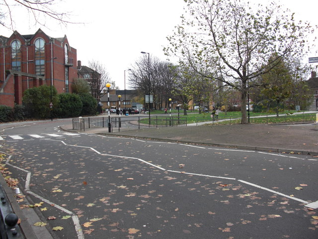
Blue Bell pub (site of) 12, St Marychurch Street, Rotherhithe, London, SE16
Obtained details of this from a 1868 map but could not track down much information about the place. It was still standing in 1935 but I do not know if it was still a pub. Then its address was 1, Lower Road. It would have stood close to the south entrance to Rotherhithe Tunnel, just behind and slightly left of the tree in the foreground. A two storey building diagonally opposite the 'Europa' and three small buildings from the large 4 storey 'Princess Victoria'. Previously called the 'Bell Tap'.
 Map © Crown Copyright")
TIP: Click the map for more Large scale mapping
- Grid Square
- TQ3579, 756 images (more nearby 🔍)
- Photographer
- Chris Lordan (more nearby)
- Date Taken
- Tuesday, 24 November, 2009 (more nearby)
- Submitted
- Monday, 30 November, 2009
- Subject Location
-
OSGB36:
 TQ 350 796 [100m precision]
WGS84: 51:29.9522N 0:3.3129W - Camera Location
-
OSGB36: TQ 349 795
- View Direction
- East-northeast (about 67 degrees)