2009
TM5593 : Lowestoft: the Euroscope
taken 14 years ago, near to Lowestoft, Suffolk, England
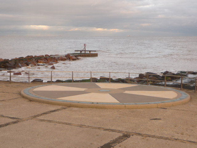
Lowestoft: the Euroscope
Marking the easternmost point of Great Britain, this concrete instalment on the foreshore has around its circumference dots at 11¼º intervals, marking the intermediate bearings as well as the main compass points, and distance markers to many major European cities pointing in the relevant direction. Also included are the other three extremities of the British mainland Lizard Point, Point of Ardnamurchan and Dunnet Head.
Some of these are quite interesting to envisage: the fact that it is 133 miles, almost spot-on due east, to Amsterdam compared to the 106 miles to London, seems at first somewhat surprising. I am significantly closer to several European destinations than to my home in Bournemouth!
Beyond it, we see the very last bit of Britain a rocky breakwater extending a few yards farther out than the promenade.
 Map © Crown Copyright")
TIP: Click the map for more Large scale mapping
- Grid Square
- TM5593, 335 images (more nearby 🔍)
- Photographer
- Chris Downer (more nearby)
- Date Taken
- Saturday, 28 November, 2009 (more nearby)
- Submitted
- Tuesday, 1 December, 2009
- Subject Location
-
OSGB36:
 TM 555 936 [100m precision]
WGS84: 52:28.8575N 1:45.7433E - Camera Location
-
OSGB36: TM 555 936
- View Direction
- East-northeast (about 67 degrees)