2006
SK2190 : Foulstone Delf
taken 18 years ago, 5 km W of Low Bradfield, Sheffield, England
This is 1 of 4 images, with title starting with Foulstone in this square
Foulstone Delf
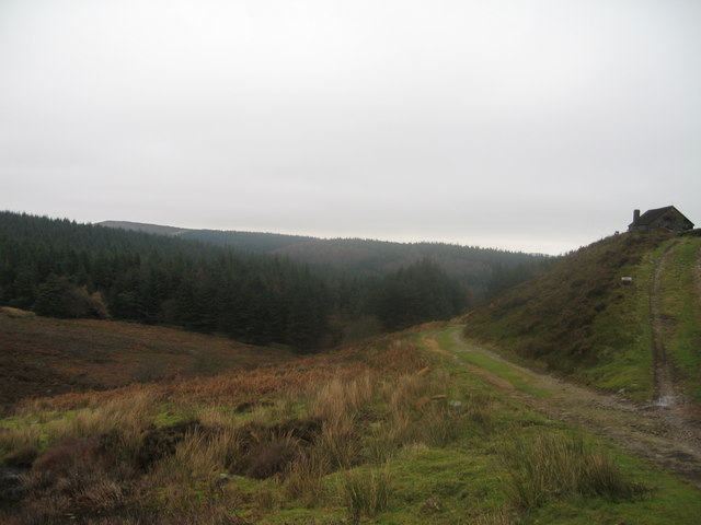
The stone building known as Foulstone Delf taken from Foulstone Road looking back eastwards to Brogging Moss Plantation. This is the moorland path leading from the historical Strines Inn SK2290 up to the fine views of Derwent Edge. Foulstone Dike is the small stream providing drainage at the left of the view.
 Map © Crown Copyright")
TIP: Click the map for more Large scale mapping
- Grid Square
- SK2190, 10 images (more nearby 🔍)
- Photographer
- Barry Hurst (more nearby)
- Date Taken
- Thursday, 19 January, 2006 (more nearby)
- Submitted
- Sunday, 30 April, 2006
- Subject Location
-
OSGB36:
 SK 214 909 [100m precision]
WGS84: 53:24.8686N 1:40.7703W - Camera Location
-
OSGB36: SK 212 909
- View Direction
- EAST (about 90 degrees)