2006
ST1629 : Whiskey Trail Crossing
taken 18 years ago, near to Greenway, Somerset, England
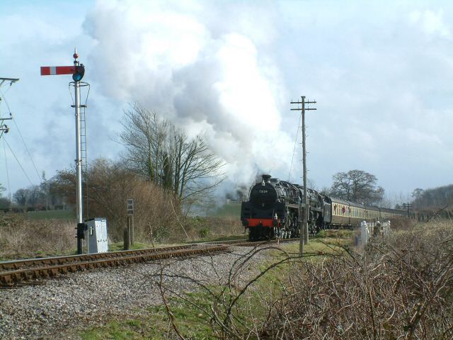
Whiskey Trail Crossing
Sandy Lane is a public footpath that links Sandhill Park and Bishops Lydeard. The alternative name of Whiskey Trail came from the American servicemen billeted in the grounds of the Park during WW2. It crosses the West Somerset Railway as shown in the picture.
 Map © Crown Copyright")
TIP: Click the map for more Large scale mapping
- Grid Square
- ST1629, 308 images (more nearby 🔍)
- Photographer
- Steve Edge (more nearby)
- Date Taken
- Friday, 24 March, 2006 (more nearby)
- Submitted
- Saturday, 6 May, 2006
- Subject Location
-
OSGB36:
 ST 161 298 [100m precision]
WGS84: 51:3.6831N 3:11.9169W