2010
TQ3118 : Hoadley's Corner
taken 14 years ago, near to Burgess Hill, West Sussex, England
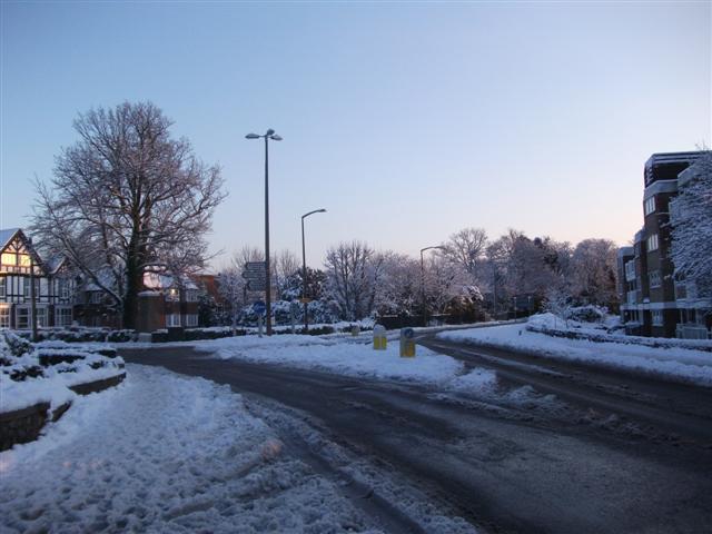
Hoadley's Corner
This roundabout is at Hoadley's Corner, a junction so named because of a department store that used to occupy the building to the left of this image. It is now more commonly known by locals as "the top of the town". Taken from Keymer Road (B2113) to Burgess Hill town centre. First exit is Junction Road, second exit to the immediate left of the mock tudor building is Silverdale Road, third exit is Keymer Road (B2113) towards Keymer.
 Map © Crown Copyright")
TIP: Click the map for more Large scale mapping
- Grid Square
- TQ3118, 85 images (more nearby 🔍)
- Photographer
- Curtis Bateman (more nearby)
- Date Taken
- Thursday, 7 January, 2010 (more nearby)
- Submitted
- Friday, 8 January, 2010
- Subject Location
-
OSGB36:
 TQ 317 187 [100m precision]
WGS84: 50:57.1721N 0:7.5655W - Camera Location
-
OSGB36: TQ 317 187
- View Direction
- South-southeast (about 157 degrees)