2010
NM9725 : Beinn Ghlas windfarm, Argyll
taken 14 years ago, near to Carn Gaibhre [hill or Mountain], Argyll And Bute, Great Britain
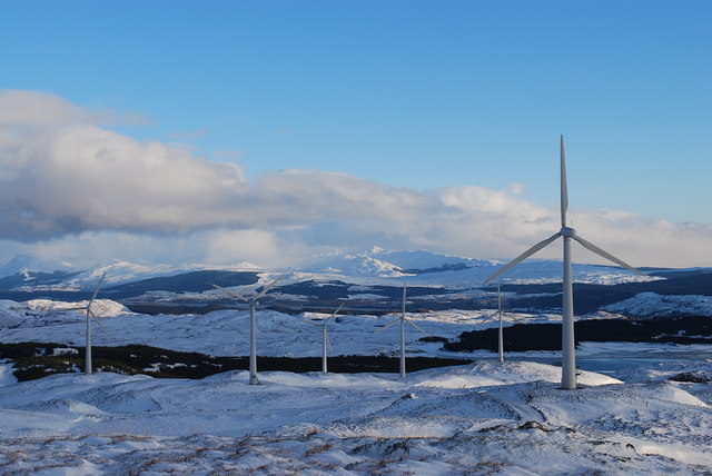
Beinn Ghlas windfarm, Argyll
This photograph of the Beinn Ghlas windfarm was taken on a bitterly cold day at New Year 2010 at about 450 metres, near to the village of Taynuilt. Loch Awe is visible to the east in the middle distance and Beinn Bhuidhe in the background.
 Map © Crown Copyright")
TIP: Click the map for more Large scale mapping
- Grid Square
- NM9725 (more nearby 🔍)
- Photographer
- Adrian Shaw (more nearby)
- Date Taken
- Saturday, 2 January, 2010 (more nearby)
- Submitted
- Tuesday, 12 January, 2010
- Subject Location
-
OSGB36:
 NM 974 256 [100m precision]
WGS84: 56:22.7488N 5:16.9713W - Camera Location
-
OSGB36: NM 974 256
- View Direction
- EAST (about 90 degrees)