N6062 : Ruined Church
taken 18 years ago, near to Delvin, Co Westmeath, Ireland
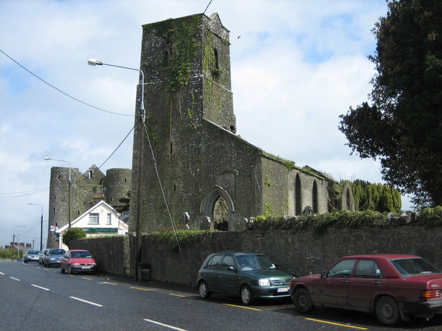
Ruined Church
On the main street of Delvin. Delvin Castle is to the left of the church.
![Creative Commons Licence [Some Rights Reserved]](https://s1.geograph.org.uk/img/somerights20.gif)
|
· Find out How to reuse this image ·
Share:
|
|||||
| Start a discussion on N6062 | Suggest an update to this image | Contact the contributor | |||
Loading map... (JavaScript required)
- Grid Square
- N6062, 10 images (more nearby
 )
)
- Photographer
- Brian Shaw (find more nearby)
- Date Taken
- Wednesday, 3 May, 2006 (more nearby)
- Submitted
- Tuesday, 9 May, 2006
- Category
- Church (ruined) (more nearby)
- Subject Location
-
Irish:
 N 60 62 [1000m precision]
WGS84: 53:36.5419N 7:5.2024W
Image classification(about):
Geograph
This page has been viewed about 98 times.
View this location:
KML (Google Earth) ·
Google Maps ·
Bing Maps ·
Geograph Coverage Map ·
More Links for this image
·
Bing Maps ·
Geograph Coverage Map ·
More Links for this image