2010
NH6786 : Struie Hill in winter, from Fearn
taken 14 years ago, near to Dounie, Highland, Scotland
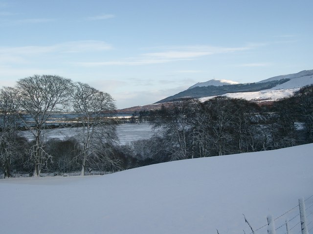
Struie Hill in winter, from Fearn
Taken from the A836 by Fearn, looking east to the summit of Struie on a winter afternoon. The railway line runs on an embankment along the edge of the Dornoch Firth (behind the tree on the left) making a shallow "lagoon" in the mid-distance beyond the field.
 Map © Crown Copyright")
TIP: Click the map for more Large scale mapping
- Grid Square
- NH6786, 14 images (more nearby 🔍)
- Photographer
- nairnbairn (more nearby)
- Date Taken
- Saturday, 30 January, 2010 (more nearby)
- Submitted
- Monday, 1 February, 2010
- Subject Location
-
OSGB36:
 NH 677 865 [100m precision]
WGS84: 57:50.9025N 4:13.8400W - Camera Location
-
OSGB36: NH 633 872
- View Direction
- EAST (about 90 degrees)