G7083 : Farm in valley below Balbane
taken 14 years ago, 8 km N of Killybegs, Co Donegal, Ireland
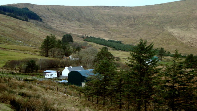
Farm in valley below Balbane
Evidence that this valley was once heavily populated lies in the number of ruins along the roadside. At present there are about four working households near to this point.
![Creative Commons Licence [Some Rights Reserved]](https://s1.geograph.org.uk/img/somerights20.gif)
|
· Find out How to reuse this image ·
Share:
|
|||||
| Start a discussion on G7083 | Suggest an update to this image | Contact the contributor | |||
Loading map... (JavaScript required)
- Grid Square
- G7083 (more nearby
 )
)
- Photographer
- louise price (find more nearby)
- Date Taken
- Monday, 8 February, 2010 (more nearby)
- Submitted
- Monday, 8 February, 2010
- Category
- Landscape (more nearby)
- Subject Location
-
Irish:
 G 708 839 [100m precision]
WGS84: 54:42.1545N 8:27.1465W - Camera Location
-
Irish: G 708 838
- View Direction
- North-northeast (about 22 degrees)
This page has been viewed about 34 times.
View this location:
KML (Google Earth) ·
Google Maps ·
Bing Maps ·
Geograph Coverage Map ·
More Links for this image
·
Bing Maps ·
Geograph Coverage Map ·
More Links for this image