2010
NN5521 : View down Auchtubhmore Hill
taken 14 years ago, near to Auchtubh, Stirling, Scotland
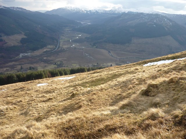
View down Auchtubhmore Hill
To the south, the grassy slopes of Auchtubhmore Hill change to forest, with the meanders of the River Balvag visible beyond.
 Map © Crown Copyright")
TIP: Click the map for more Large scale mapping
- Grid Square
- NN5521 (more nearby 🔍)
- Photographer
- Gordon Morrison (more nearby)
- Date Taken
- Thursday, 18 February, 2010 (more nearby)
- Submitted
- Thursday, 18 February, 2010
- Subject Location
-
OSGB36:
 NN 558 217 [100m precision]
WGS84: 56:21.9459N 4:20.0896W - Camera Location
-
OSGB36: NN 558 219
- View Direction
- SOUTH (about 180 degrees)