2010
NN8632 : Allt a'Bharnie
taken 14 years ago, near to Newton, Perth And Kinross, Scotland
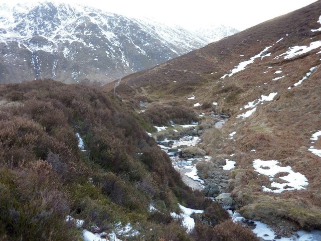
Allt a'Bharnie
The burn flows gently in this high corrie before it drops steeply into Glen Almond.
The craggy north face of Meall Dubh, on the other side of the glen, shows in the background.
The craggy north face of Meall Dubh, on the other side of the glen, shows in the background.
 Map © Crown Copyright")
TIP: Click the map for more Large scale mapping
- Grid Square
- NN8632, 3 images (more nearby 🔍)
- Photographer
- Gordon Morrison (more nearby)
- Date Taken
- Sunday, 21 February, 2010 (more nearby)
- Submitted
- Sunday, 21 February, 2010
- Subject Location
-
OSGB36:
 NN 868 323 [100m precision]
WGS84: 56:28.1949N 3:50.2952W - Camera Location
-
OSGB36: NN 869 325
- View Direction
- South-southwest (about 202 degrees)