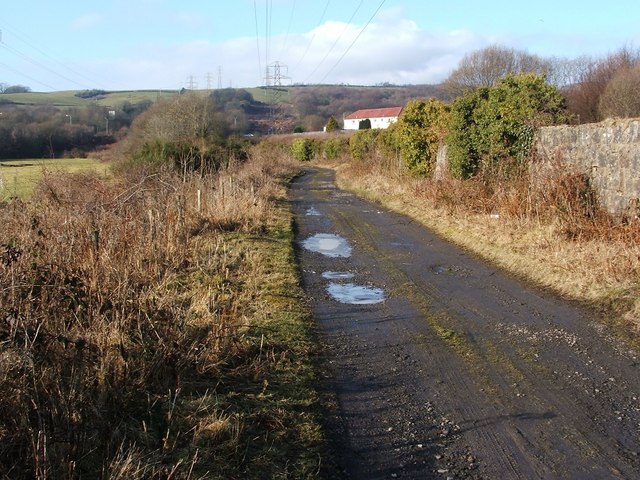
NS3977 : The Howgate
taken 14 years ago, near to Renton, West Dunbartonshire, Scotland
See Link
(an annotated satellite view) for the original line (in yellow) and the current line (in green) of this track.
As explained in a Geograph article Link the track, on its original line, provided access to Pillanflatt Farm and to the River Leven; the riverside meadow at the eastern end of the track was once known as Sandyholme (see Link for comments on that name and its possible relation to that of the Howgate).
Expansion of the Dalquhurn Dye Works had swallowed that farm by 1860, and the original course of the Howgate would gradually fall into disuse and would likewise be consumed by the expanding works. The present-day Howgate, running some way to the south of the original one, represents the course of a long-dismantled railway branch line, first shown on the 1896 map revision.
The Howgate now leads from the main road (the Renton Road) to meet a foot/cycle path beside the River Leven. A building called Howgate Lodge was formerly located at NS38657749, near the western end of the track, but it was cleared away when the A82 (dual carriageway) was built. There was also a Howgate Cottage (likewise long gone) partway along the track, at NS38997753, on or near the spot where the farmhouse of Pillanflatt earlier stood.
 Map © Crown Copyright")
- Grid Square
- NS3977, 336 images (more nearby 🔍)
- Photographer
- Lairich Rig (more nearby)
- Date Taken
- Thursday, 18 February, 2010 (more nearby)
- Submitted
- Wednesday, 24 February, 2010
- Subject Location
-
OSGB36:
 NS 3904 7745 [10m precision]
WGS84: 55:57.7803N 4:34.8109W - Camera Location
-
OSGB36: NS 3909 7742
- View Direction
- West-northwest (about 292 degrees)