2010
SC4180 : The level crossing at the junction of the A11 with the A2
taken 14 years ago, near to Baldrine, Isle of Man
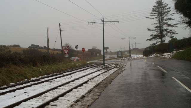
The level crossing at the junction of the A11 with the A2
 Map © Crown Copyright")
TIP: Click the map for more Large scale mapping
- Grid Square
- SC4180, 15 images (more nearby 🔍)
- Photographer
- David Long (more nearby)
- Date Taken
- Wednesday, 24 February, 2010 (more nearby)
- Submitted
- Saturday, 27 February, 2010
- Subject Location
-
OSGB36:
 SC 419 802 [100m precision]
WGS84: 54:11.6144N 4:25.4712W - Camera Location
-
OSGB36: SC 418 801
- View Direction
- North-northeast (about 22 degrees)